السبت، 28 يناير 2012

Ravinement Erosion Surface


Ravinement Erosion Surface

A time transgressive or diachronous subaqueous erosional surface resulting from nearshore marine and shoreline erosion associated with a sea-level rise. This erosional surface parallels the migration of the shoreface "razor" across previously deposited coastal deposits. Burrows in this surface are often filled by sediments deposited during a sea-level rise.

Ravinement surfaces are commonly ascribed to the transgressive movement of the landward margin of the Transgressive Systems Tract. these erosional surfaces will tend to occur
wherever the landward edge of the sea rises over an underlying sedimentary surface. Thus if the Late Lowstand Systems Tract has a subaerial landward margin it will have an updip ravinement surface associated with it.

In outcrops and wells ravinement surfaces are commonly equated with the transgressive surface. these erosional surfaces are time transgressive and tend to occur wherever the landward edge of the sea rises over an underlying sedimentary surface. They only match the transgressive surface when it tops the shelf margin.

Glossifungites burrows are formed during the development of this regressive surface of erosion and are often filled by the reworked sediments associated with the landward margin of following transgression and maximum flooding surface. In this later case Glauconitic sediments, gravels and sand sized grains are the common reworked sediments overlying this surface. The log response of ravinement often provides evidence of carbonate cementation. This ravinement surface is equated to the transgressive surface.

Well Logs


Well Logs


There are many different types of well logs. Some of the logs that are used to interpret the rocks in a well are discussed below. Other types of logs measure temperatures, the flow rate of oil and gas that is being produced in the well, and the quality of cement used to bond production pipe (which is actually called casing) to the surrounding rock. Today, there are even cameras that can be lowered into wells to make videos of the inside of the casing and determine what types of fluids are flowing out of perforation holes shot into the casing.

GR (gamma ray) logs measure radioactivity to determine what types of rocks are present in the well. Because shales contain radioactive elements, they emit lots of gamma rays. On the other hand, clean sandstones emit very few gamma rays.

SP (spontaneous potential) logs indicate the permemabilities of rocks in the well by measuring the amount of electrical current generated between the drilling fluid and the formation water that is held in pore spaces of the reservoir rock. Porous sandstones with high permeabilities tend to generate more electricity than impermeable shales. Thus, SP logs are often used to tell sandstones from shales.

Resistivity logs determine what types of fluids are present in the reservoir rocks by measuring how effective these rocks are at conducting electricity. Because fresh water and oil are poor conductors of electricity they have high resistivities. By contrast, most formation waters are salty enough that they conduct electricity with ease. Thus, formation waters generally have low resistivities. There are many different types of resistivity logs, which results in a confusing array of acronyms.

BHC (borehole compensated) logs, also called sonic logs, determine porosity by measuring how fast sound waves travel through rocks in the well. In general, sound waves travel faster through high-density shales than through lower-density sandstones.

FDC (formation density compensated) logs, also called density logs, determine porosity by measuring the density of the rocks. Because these logs overestimate the porosity of rocks that contain gas they result in "crossover" of the log curves when paired with Neutron logs (described under CNL logs below).

CNL (compensated neutron) logs, also called neutron logs, determine porosity by assuming that the reservoir pore spaces are filled with either water or oil and then measuring the amount of hydrogen atoms (neutrons) in the pores. Because these logs underestimate the porosity of rocks that contain gas they result in "crossover" of the log curves when paired with FDC logs (described above).

NMR (nuclear magnetic resonance) logs may be the well logs of the future. These logs measure the magnetic response of fluids present in the pore spaces of the reservoir rocks. In so doing, these logs measure both porosity and permeability, as well as the types of fluids present in the pore spaces.

Dipmeter logs determine the orientations of sandstone and shale beds in the well, as well as the orientations of faults and fractures in these rocks. The original dipmeters did this by measuring the resisitivity of rocks on at least four sides of the well hole. Modern dipmeters actually make a detailed image of the rocks on all sides of the well hole. Borehole scanners do this with sonic (sound) waves, whereas FMS (formation microscanner) and FMI (formation micro-imager) logs do this by measuring the resisitivity. These modern, essentially 3D logs are known as image logs since they provide a 360°ree; image of the bore hole that can show bedding features, faults and fractures, and even sedimentary structures, in addition to providng basic dipmeter data on the orientations of bedding.


LWD and MWD versus Wireline Tools

Wireline refers to the logging technique in which after a well has finished drilling and reached TD (total depth), the logging tool is lowered down the hole the hole on a cable (i.e., the wireline). As the tool is brought to the surface ,it measures data (gamma ray, resistivity, etc.) from which the log for the well is constructed.

LWD and MWD are acronyms for "Logging While Drilling" and "Measurement While Drilling" and refer to the technique of placing the logging tool somewhere behind the drill bit so that it can record data during the actual drilling. Depending on far the tool sits behind the bit, the data can be measured, more or less, in real time to create Realtime Logs at the surface. After the tool is pulled from the hole, data can then be downloaded from the tool itself to create what are called Memory Logs, which are higher resolution and more reliable than the Realitme logs.


Acronyms of Resistivity Logs

There are many different types of resisitivity logs, which differ primarily in how far into the rocks they measure the resisitivity. Because drilling fluids tend to force their way into the surrounding rock, resisitivity logs with shallow depths of investigation are unable to see beyond an "invasion zone" to determine the true formation water resisitivy of permeable rocks. Instead, these logs measure the lower resisitivity of the contaminated zone. Thus, by pairing logs with deep and shallow depths of investigation, it is possible to measure permeability by looking at the resisitivity diffences between the logs. The acronyms of some of the more popular resisitivity logs are listed below.

AIT (Array Induction Tool) - the resistivity log of the future. It measures five depths of investigation.

DIL (Dual Indiction Log) - a frequently used log with deep and medium depths of investigation.

DLL (Dual Laterolog) - a frequently used log with deep and medium depths of investigation.

LAT (Lateral Log)- an obsolete log with a deep depth of investigation.

LN (Long Normal) - an obsolete log with a deep depth of investigation.

RPCLM (Phased Resistivity) - an LWD/MWD log with a shallow depth of investigation.

RACLM (Attenuated Resistivity) - an LWD/MWD log with a deep depth of investigation.

SFL (Spherically Focused Log) - a frequently used log with a shallow depth of investigation.

SGR (Shallow Guard Log) - a frequently used log with a shallow depth of investigation.

SN (Short Normal) - an obsolete log with a shallow depth of investigation.

الجمعة، 30 ديسمبر 2011

What is Earth Science?

Introduction


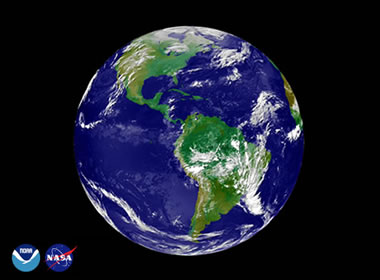
Earth Science is the study of the Earth and its neighbors in space. It is an exciting science with many interesting and practical applications. Some Earth scientists use their knowledge of the Earth to locate and develop energy and mineral resources. Others study the impact of human activity on Earth's environment and design methods to protect the planet. Some use their knowledge about Earth processes such as volcanoes, earthquakes and hurricanes to plan communities that will not expose people to these dangerous events.


The Four Earth Sciences


Many different sciences are used to learn about the earth, however, the four basic areas of Earth science study are: geology, meteorology, oceanography and astronomy. A brief explanation of these sciences is provided below.


Geology: Science of the Earth


Geology is the primary Earth science. The word means "study of the Earth". Geology deals with the composition of Earth materials, Earth structures, and Earth processes. It is also concerned with the organisms of the planet and how the planet has changed over time. Geologists search for fuels and minerals, study natural hazards, and work to protect Earth's environment.


Meteorology: Science of the Atmosphere


Meteorology is the study of the atmosphere and how processes in the atmosphere determine Earth's weather and climate. Meteorology is a very practical science because everyone is concerned about the weather. How climate changes over time in response to the actions of people is a topic of urgent worldwide concern. The study of meteorology is of critical concern for protecting Earth's environment.


Oceanography: Science of the Oceans


Oceanography is the study of Earth's oceans - their composition, movement, organisms and processes. The oceans cover most of our planet and are important resources for food and other commodities. They are increasingly being used as an energy source. The oceans also have a major influence on the weather and changes in the oceans can drive or moderate climate change. Oceanographers work to develop the ocean as a resource and protect it from human impact. The goal is to utilize the oceans while minimizing the effects of our actions.


Astronomy: Science of the Universe


Astronomy is the study of the universe. Here are some examples of why studying space beyond Earth is important: the moon drives the ocean's tidal system, asteroid impacts have repeatedly devastated Earth's inhabitants and energy from the sun drives our weather and climates. A knowledge of astronomy is essential to understanding the Earth. Astronomers can also use a knowledge of Earth materials, processes and history to understand other planets - even those outside of our own solar system.


The Importance of Earth Science

Today we live in a time when the Earth and its inhabitants face many challenges. Our climate is changing and that change is being caused by human activity. Earth scientists recognized this problem and will play a key role in efforts to resolve it. We are also challenged to: develop new sources of energy that will have minimal impact on climate; locate new sources of metals and other mineral resources as known sources are depleted; and, determine how Earth's increasing population can live and avoid serious threats such as volcanic activity, earthquakes, landslides, floods and more. These are just a few of the problems where solutions depend upon a deep understanding of Earth science.


Earth Science Careers


If you are a pre-college student you can start preparing for a career in Earth science by enrolling in the college preparation program and doing well in all of your courses. Science courses are especially important but math, writing, and other disciplines are also used by Earth scientists during every working day.

Some universities have Earth Science programs but most offer more specific training in programs such as geology, meteorology, oceanography or astronomy. In these programs you will be required to take some challenging courses such as chemistry, physics, biology and math. Earth science is an integrated science and professionals in that field must solve problems that require a knowledge of several fields of science.

If you already have a degree in another discipline such as biology, chemistry, geography or physics, you might be able to go to graduate school and obtain a Master's degree in one of the Earth sciences. That will most likely require taking some undergraduate courses to meet program entry requirements. However, if you have a strong interest in Earth science it is probably worth doing.

At present, job opportunities in many areas of the Earth sciences are better than average - even with the down economy. Opportunities in geology are especially good.

Visit the website of a school that offers a geology degree, get in touch with the geology department, let them know you are interested and make arrangements to visit the campus. Don't be hesitant. Good schools and professors want to be contacted by interested students


الأربعاء، 26 يناير 2011

Reverence and fissures in the mountains

The meanings of scientific and Qur'anic revelations

A. D. Otherwise Ghalibi

Division of Geography - Faculty of Arts and Humanities

- University of Mohammed I - Kingdom of Morocco

Allah says in Surat Al-Hashr: {Had We sent down this Qur'an on a mountain, I have seen it humble itself and cleave asunder for fear of Allah and those parables which We propound to men that they may reflect}. This means that the mountains are subject and cracked from the fear of God, if the Qur'anic discourse is directed, "says Tahar Ben Achour in the interpretation of liberation and enlightenment:" The discourse in (I saw) for non-specific Afeem one who hears this speech, and vision visual and is exiled because it is located an answer to a letter (if) Alamtnaip. " Does the fact that the humble mountains and cracking is the reality of the lack of landing the Koran?, In other words, does the absence of a reaction condition (if sent down), not necessarily lead to the absence of an answer to the condition (have seen)?.